Mapping the effects of zoning reform bill SB 827
In early 2018, California State Senator Scott Wiener introduced California State Senate bill 827, a zoning-reform bill intended to increase housing density around public transit. The bill would override local zoning controls on height, density, parking minimums, and design review on properties within a certain distance of major public transit infrastructure.
A small group of people joined together to map the impacts this bill would have across the state if passed. How would San Francisco change? LA? For any given region, is it near transit such that it would be affected by the bill? If so, what would the effect be on current zoning? We wanted to make the effects of the bill legible: to ourselves, to the public, and to lawmakers representing various districts.
First, we mapped "transit rich areas" by identifying which transit stops would qualify as "major" and "high frequency." Sasha Aickin took the lead on this part, using GTFS feeds to identify which train, bus, and ferry stops / corridors matched designations in the bill.
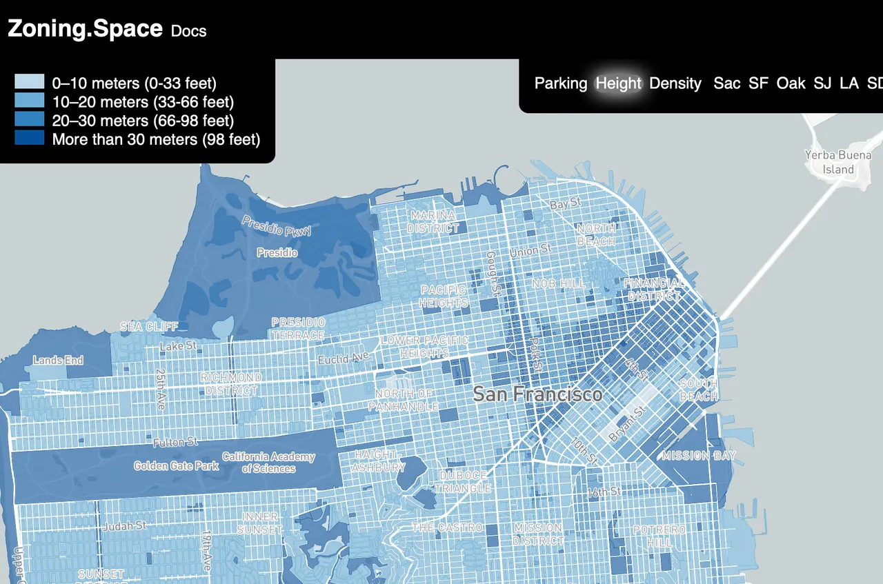
Next, we canonicalized existing zoning laws. We needed to map existing zoning across the state so we could understand the net change the bill would have. Zoning laws are in English, not in code, and they can be complicated. We needed to normalize these laws into a standard schema. Mat Conway and Hunter Owens took the lead on this part, developing a new machine-readable format and doing a lot of manual labor to convert the text of zoning laws into polygons with associated data: height limits, parking requirements, and the maximum units allowed.
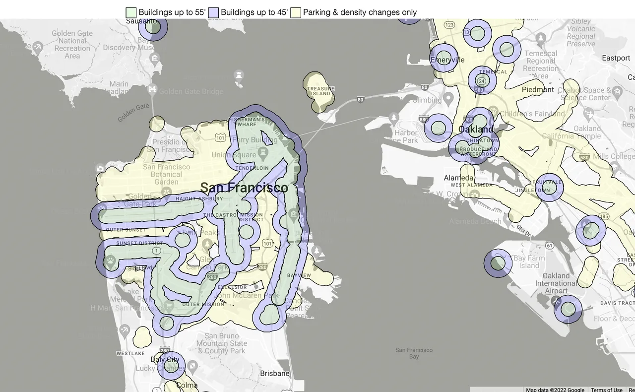
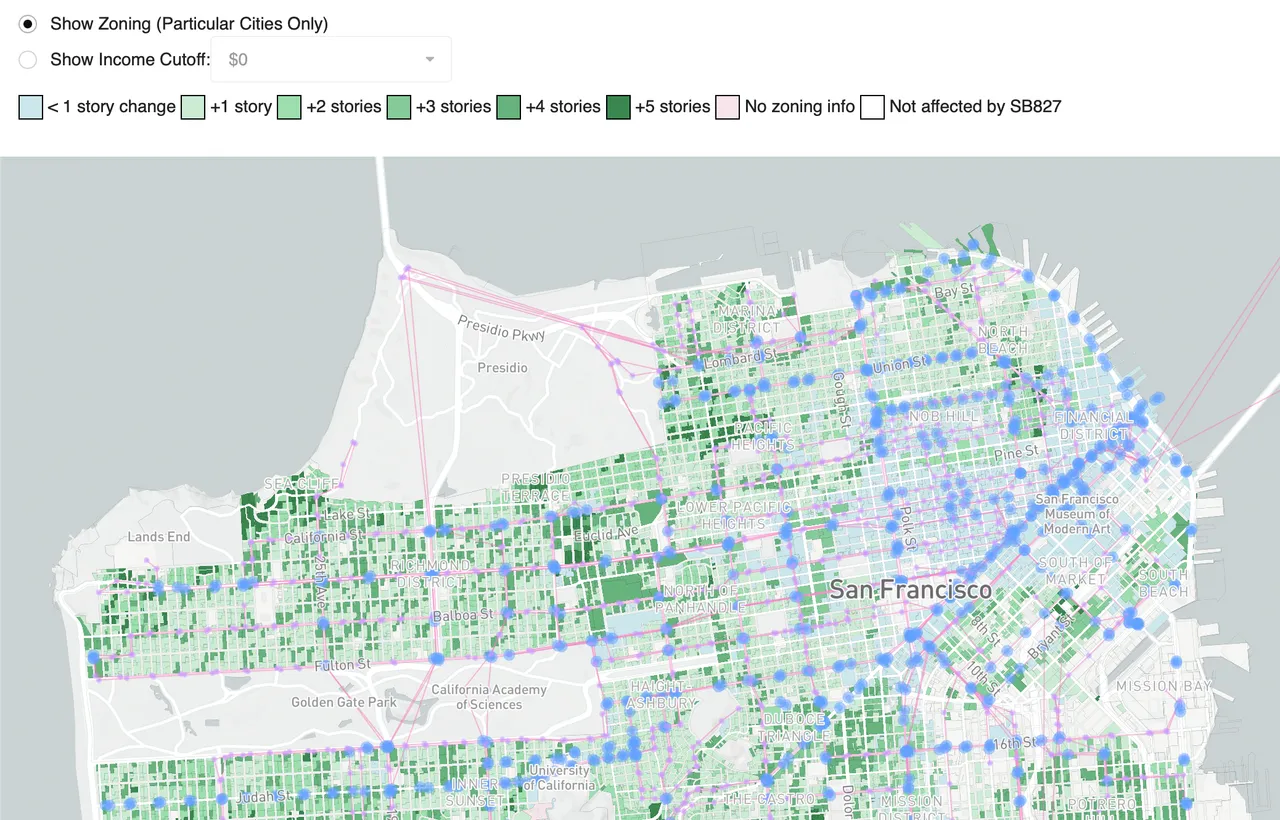
Finally, we visualized the changes the bill would have. I took the lead on processing the atomic unit in land-use: the parcel. Using public parcel and road data, I identified each parcel's (1) existing zoning restrictions (2) what designation, if any, it fell under with SB 827 and (3) the net changes the bill would have. With this approach, you can look up any parcel of land in the state of California and understand the effects of SB 827. We found that some areas like Chinatown in San Francisco would qualify, but would not be affected due to loose existing zoning standards. Areas such as the Richmond district along the 38R Geary bus line would see more dramatic zoning changes due to lower existing height limits and single-family zoning.
Reflections
I should note that the precision of our analysis is fuzzy: zoning laws are complex and public data can be out of date or incomplete, so the act of canonicalizing these texts into computer speak is lossy. Also, a bill like SB 827 is fluid as the bill authors respond to critiques through the legislative session, so our analysis lagged behind. Still, I believe we built a useful tool to visualize and better understand the effects the proposed bill might have across the state of California.
This project was incredibly rewarding for a few reasons:
I enjoyed working with a group of people motivated to use software to push forward public policy. The customized reports we generated for specific State Senators and Assembly members cut through the rhetoric and made plain the effects of BS 827 in their districts. This both alleviated concerns and illuminated some shortcomings with the bill.
I enjoyed divvying up a large workload based on our divergent skill sets and joining our pieces into a whole that was greater than the sum of its parts. Collaborating with talented people is a real pleasure, and rarer than you might think.
This effort rekindled my love for maps. Seeing the world from above is something I've always enjoyed, whether that be aerial photography, floor plans, or maps. The world of geospatial software is one with a unique set of problems, standards, and best practices. It was fun revisiting the space after a few years away, first having explored it during my internship with SimpleGeo.
Working on this project created a way for my girlfriend and I to join our worlds for a brief moment in time: hers being public policy, transit, and land use, and mine being software architecture, data processing, and easy-to use interfaces. Our excited chats on the phone about how we might collaborate on a shared project were special for me.